In previous articles, we have looked at how archaeology can be utilized by Christians who affirm the historicity of the Old Testament events. Though many in our day claim that archaeology causes problems for believers, we have asked whether this is truly the case. Indeed, as we have seen thus far, archaeology creates problems only for those who presuppose that the biblical texts contain historical errors and that archaeology is a hard science that speaks more truthfully than the Bible. Christians who believe that God’s Word is true appropriate the observations of archaeology very differently and study it with an eagerness and excitement because of the wonderful role it can play in contextualizing and illustrating many aspects of the biblical text. Before we consider what archaeology can tell us about the exodus and wilderness wanderings of the Israelites, we should consider a brief methodological point.
Shall We Then Harmonize?
The word harmonization is often used in biblical studies to describe how believing scholars reconcile apparent discrepancies and inconsistencies in the Bible. It is often claimed that attempts to harmonize these seemingly discrepant passages are an artificial and contrived practice. Not only do critics scoff at harmonizing seemingly disparate textual claims, they do the same with attempts to harmonize the claims of Scripture and science and, as in our case, the claims of Scripture and archaeology. Critics say we need to admit that these two sources stand in true contradiction to one another and then side with the “more objective” conclusions of science. From there, we are asked to accept the Bible as a religious, though not historical, document. It hardly needs stating that such a proposal stands in stark contrast with what the Bible itself claims to be (i.e., the divinely inspired, infallible, and thus authoritative Word of God), but our interest is in why critics would be so quick to dismiss harmonization when harmonization is a regular part of human experience.
In reality, skeptics are unable to live according to their own professed beliefs about harmonization. The late Raymond Dillard of Westminster Theological Seminary points out that “The question is not ‘should we harmonize or not,’ for harmonization is a virtually universal and inevitable feature of daily life. At home parents confront sharply different versions of a recent squabble between children . . . and [try] to create a scenario . . . closer to what a more detached observer would have reported or what would have been recorded on videotape.”1 While there are times one child is lying, other times both children are speaking the truth, only each is emphasizing one aspect more than others. Dillard insists: “Encounters like these are regular features of daily life. . . . One cannot a priori or simplistically repudiate harmonization of biblical data without contradicting what would be a routine and natural response to data in other areas of life.”2 Indeed, even ancient historians routinely work to harmonize different sets of data. As an example, Matt Waters, a professor at the University of Wisconsin-Eau Claire, practices this very thing in his recently published history of the Persian Empire.3 As they say, “What’s good for the goose is good for the gander”; Christians should feel no embarrassment for doing the hard work of seeking to harmonize the difficult data that archaeology presents with the historical narrative that Scripture provides.
The Location of Egypt’s Capital
Following the final plague, Pharaoh relented and let the Israelites leave Egypt. Exodus 12:37 says that they traveled from Rameses to Succoth. Exodus 13:20 then notes their travel from Succoth to Etham at the edge of the wilderness. Exodus 14:2 records that Israel then turned back and camped “in front of Pi-hahiroth, between Migdol and the sea, in front of Baal-zephon.” We often skim past these names since most of us are not well versed in ancient topography. But historians have not been so quick to pass over these, and some have even claimed that these place names are proof that Exodus does not record true history. One example will illustrate.
In the early 1900s, archaeologists were divided on the location of biblical Rameses (called Pi-Ramesses in Egyptian sources). The site of San el-Hagar (ca. 75 miles northeast of Cairo), also known as Tanis, was believed to be the location of Rameses because stonework and bricks inscribed with the name Rameses were present at the site. The problem, however, is that Tanis was not built until the eleventh century B.C., which not only was later than the Ramesside period but also was too late to accommodate either of the main dates proposed by conservative scholars for the exodus.4 Archaeological excavations about 10 miles southwest of Tanis at the adjacent sites of Qantir and Tell el-Dab‘a, however, yielded royal palaces with more inscribed Ramesside inscriptions. Tell el-Dab‘a was identified as the former Hyksos capital, Avarris, and nearby Qantir has been identified as Rameses. While adherents to a fifteenth-century B.C. exodus date recognize that Qantir itself did not flourish until the thirteenth century B.C., they note that the remains are of a huge city that encompassed also the site of Tell el-Dab‘a, which was present already in the fifteenth century B.C.5 Thus both positions can rightly claim this site as support.
Though there is nearly universal agreement by scholars about the location of Rameses at Qantir/Tell el-Dab‘a, some critical writers have claimed that the exodus stories were written late in Israel’s history and are merely a retrojection of places and names that bear little resemblance with real history. When critical Egyptologist Donald Redford insisted that linguistics did not allow for an identification of the biblical name Rameses with the Egyptian name Pi-Ramesses, minimalist scholars capitalized on this. Lester Grabbe, for example, argued that Rameses (as opposed to Pi-Ramesses) was a widespread topographical name in the first millennium B.C. and thus the stories of the exodus do not describe Pi-Ramesses of ancient Egypt, but realities from a much later period.6 Another linguist, Wolfgang Heck, however, wrote a thorough critique of Redford’s work forcing critical scholars either to sheepishly admit Redford’s errors or ignore Heck’s critique.7 Indeed, the only way the biblical texts could speak as they do about the geography of the exodus and its beginnings at Rameses is if they truly reflect the historical reality of the Late Bronze Age in Egypt. The only other option for critical scholars is to posit that the supposed “late inventors” of the exodus story wholly by accident gave the precise name for the Egyptian capital at the time when the exodus was said to have happened! Such naïve and blind faith is ironic. After all, critical scholars claim that faith should not inform one’s study of ancient history.
The Location of the Re(e)d Sea
When I was young, I distinctly remember seeing a map of the Middle East and feeling excited when I saw the Red Sea bordering the west coast of Saudi Arabia. I thought for sure that modern-day maps had accurately pinpointed the body of water made famous by Exodus 14–15. Students of Hebrew, however, have sought in vain for a literal reference to a “red” sea in the Bible. Instead, the body of water through which the Israelites passed on dry ground is literally named yam suf, the Sea of Reeds. It is the Greek translation of the Old Testament, the Septuagint, which has given us the name Red Sea by translating the phrase yam sufas eruthra thalassa (Exod. 15:4). It is true that there are salt-water reeds that grow along sections of the Red Sea, but reeds are most often thought of as growing in fresh water. As Egypt has several substantial freshwater lakes within a reasonable distance of Rameses, how can we narrow down our investigation into the location yam suf?
While media claims to have found chariot wheels covered in coral and strewn across the bottom of the Gulf of Aqaba are tantalizing, in reality archaeology has not found evidence for the location of yam sufin such a sensational manner. It has, however, drawn attention to an ancient man-made feature that would have affected the Israelites’ journey to yam suf and narrows the range of options. This is the eastern border canal that quarantined off large sections of Egypt between the Great Bitter Lake, Lake Timsah, and many of the other lakes from antiquity that have disappeared since the drying up of the Pelusiac branch of the Nile River and (more recently) the digging of the Suez Canal. This eastern border canal was discovered by Israeli geologists in the 1970s and would have been in operation during the time of the exodus.8 While this man-made water barrier was noted by classical writers like Herodotus, the discovery of its remains helped scholars to better understand one of the most significant obstacles faced by the Israelites in the exodus.
Though many routes for the exodus have been proposed, several seem unlikely due to severe limitations.9 As an example, a northern route following the main road out of Egypt, the Way of Horus, would have been a much shorter and more direct journey but was funneled through a heavily guarded path peppered with Egyptian military outposts. The coast was “heavily militarized” and would have been, according to Egyptologist Kenneth Kitchen, a jump “out of the frying pan and into the fire.”10 This seems to be the concern of Exodus 13:17: “When Pharaoh let the people go, God did not lead them by way of the land of the Philistines, although that was near. For God said, ‘Lest the people change their minds when they see fighting and return to Egypt.’”
Instead of northward, God initially sent Israel in a southerly direction. Though going “up” from the land of Egypt (Exod. 13:18) sounds like traveling north, Egypt was conceived in reverse in ancient times. “Lower Egypt” was the portion of the country closest to the Mediterranean Sea (north on a map) whereas “Upper Egypt” was further south, following the Nile River upstream. When traveling in a southeasterly direction, however, the Israelites would inevitably bump up against the eastern border canal, preventing them from traveling southeast indefinitely or of even turning east at will. This seems to be reflected in Exodus 14:2, where God tells them to “turn back” (i.e., head northward) and encamp facing “the sea” (presumably yam suf, although it simply says the sea [hayam] and could refer to one of the many Ballah or Bitter lakes of antiquity and not specifically yam suf). Pharaoh himself would have seen the people as boxed in by the wilderness (Exod. 14:3).
Where then does this put our quest for the location of the Red/Reed Sea? The Bible records that after turning back, the Israelites encamped in a specific location: in front of Pi-hahiroth between Migdol and the sea, in front of Baal-Zephon (Exod. 14:2). As it turns out, ancient Egyptian texts mention these same places as all located in proximity. And what is more fascinating is that Egyptian texts locate them near a large body of water named pa-chuf in Egyptian. The name pa-chuf is linguistically related to yam suf and seems quite likely to be the same body of water.11 What is more, the name Pi-hariroth in Exodus 14:2 is related to an Egyptian term, pa-char, derived from a Semitic word meaning “canal.” In light of all this, the Red/Reed Sea seems most likely to have been located as part of the Ballah lake system, east of Rameses and east of the Nile delta. It is quite likely that the texts—biblical and ancient Egyptian—even envision the Red/Reed Sea as connected to the eastern border canal and thus a key feature of this ancient Egyptian defense system. Imagine how Pharaoh must have felt watching the Lord easily lead his people through a defense system designed to stop even the more formidable military foe!
Archaeology of the eastern border canal, combined with an understanding of ancient geography gathered from ancient Egyptian texts, encourage us to view yam suf as one of the large lakes in the Ballah lakes system. As water features east of the Nile delta have had a volatile existence, historically speaking, it is likely that the Red/Reed Sea is no longer even in existence. Over the course of the first millennium B.C., the Pelusiac branch of the Nile slowly migrated northward some 10 to 12 miles, leaving even the largest lakes to dry up and fill with sand down into the present. Indeed, since that time, the Pelusiac branch has disappeared and the digging of the Suez Canal has further changed the topography of the eastern delta. Nevertheless, we know from archaeology that a significant canal system utilized a series of large lakes in an area not far from Rameses. This helps us to contextualize the story of the exodus and reconstruct the travel itinerary of the Israelites. But speaking of travel, what do travel speeds help us understand about the locations of the exodus?
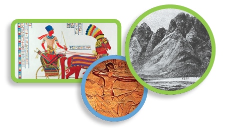
Narrowing Down Candidates for Mt. Sinai
As alluded to above, some have claimed to have found the remains of Pharaoh’s army some 200 miles southeast of Rameses in the modern-day Gulf of Aqaba. As studies of ancient travel times have shown, one day’s journey in the ancient world would cover a distance of 17 to 23 miles. How does this square with a 200-mile trip to the Gulf of Aqaba? Numbers 33 recounts the travel itinerary of the Israelites in a more systematic fashion and even includes a technical term, “stage” (or “stages,” ESV), which refers to distance one could cover in a single day. We read that the first day was a journey from Rameses to Succoth (v. 5). The second day was a journey from Succoth to Etham (v. 6). The third day was their journey back northward (the “turning back” of Exod. 14:2) to Pi-hariroth. On the fourth day, they passed through the sea. If the Gulf of Aqaba truly was the Red Sea of the Bible and really did contain Pharaoh’s chariots, the host of the Israelites, including women and children, traveled an astonishing 66 miles per day! It is hard to imagine that the Gulf of Aqaba is a reasonable location for the Red Sea.
We mention this because some in recent years have suggested that Mt. Sinai is located not in the Sinai Peninsula, where it has been traditionally located, but in Saudi Arabia at a site called Jebel al-Lawz.12 Others have posited other sites in Arabia, or sites in the northern Sinai. The work of Emmanuel Anati at Har Karkom, about 55 miles north of modern-day Eilat, has become another alternative suggestion in recent years. While the approximately 150 miles from Rameses to Har Karkom would fit within the eight-to-eleven-day time period allowed by Numbers 33:8–15, problems emerge when the journey from Mt. Sinai to Kadesh-Barnea is said to take eleven days to cover only 32 miles. One could propose that the entire assembly of Israel suddenly took on a snail’s pace, traveling just under 3 miles per day for this last leg of the journey; however, such an approach seems a bit forced.
Ancient tradition has suggested the site of Gebel Musa in the southern tip of the Sinai Peninsula is the location of Mt. Sinai. St. Catherine’s Monastery is a famous site purporting to mark the location of the burning bush (Exod. 3). While Byzantine traditions are not the most reliable for determining biblical locations, and while Gebel Musa has some limitations (e.g., it lacks room for the Israelites to camp at its base), its location seems to jibe better with consistent travel speeds and the itinerary of Numbers 33. It should be noted that Gebel Musa is located close to other mountains that have been proposed for Mt. Sinai: Gebel Serbal and Gebel Katherina. Unfortunately nothing more can be proven with the current state of archaeological knowledge. Nevertheless, archaeology has helped us to understand the beginning of the Israelites’ journey out of Egypt, and thereby provides us with some options for considering the remainder of their travels.
Conclusion
Two major conclusions can be drawn from this article. First, archaeology can help us to identify ancient cities that correspond with biblical names and thereby provide a context for the events in Scripture. This is certainly the case with the location of Rameses at Qantir/Tell el-Dab‘a, and seems likely the case with the location of the Red Sea east of Rameses in the ancient Ballah lake system. But second, archaeology cannot always be used to illustrate with the detail we might wish. This seems to be the case with the location of Mt. Sinai. Nevertheless, archaeology provides us with a useful tool for taking what might otherwise be a boring list of old cities and campsites in Exodus and Numbers and viewing them as a real itinerary with stopping points that seem viable based on known travel speeds and ancient topography. In the next installment of this series, we move into the time of Israel’s settlement in the land of Canaan. This is where archaeology begins to yield more information about the biblical text than ever before.
1. Raymond B. Dillard, “Harmonization: A Help and a Hindrance,” in Inerrancy and Hermeneutic, ed. Harvie M. Conn (Grand Rapids, MI: Baker Book House, 1988), 153.
2. Dillard, “Harmonization.”
3. Matt Waters, Ancient Persia: A Concise History of the Achaemenid Empire 550–330 BCE(Cambridge: Cambridge University Press, 2014), 39, 73.
4. Note that 1 Kings 6:1 posits 480 years between the exodus and the commencement of the temple construction. Those who interpret this time frame as an exact time marker view the exodus as taking place in the fifteenth century B.C., whereas those who view it as a figurative number representing twelve generations of forty years each place the exodus in the thirteenth century. We will consider this question more in a future article.
5. Bryant Wood, “From Ramesses to Shiloh,” in Giving the Sense: Understanding and Using Old Testament Historical Texts, ed. David M. Howard and Michael A. Grisanti (Grand Rapids, MI: Kregel, 2003), 262; idem, “The Royal Precinct at Rameses,” Associates for Biblical Research, April 3, 2008, http://www.biblearchaeology.org/post/2008/04/The-Royal-Precinct-at-Rameses.aspx.
6. Lester Grabbe, Ancient Israel: What Do We Know and How Do We Know It?(London: T&T Clark, 2007), 86.
7. For this debate and citation of Hecks’s work, see James K. Hoffmeier, Israel in Egypt: The Evidence for the Authenticity of the Exodus Tradition(Oxford: Oxford University Press, 1996), 117–18.
8. For the background of this canal and its implications for the exodus, see Hoffmeier, Israel in Egypt, 164–75.
9. For pros and cons of the various options, see Kenneth A. Kitchen, On the Reliability of the Old Testament (Grand Rapids, MI: Eerdmans, 2003), 266–72.
10. Kitchen, Reliability of the Old Testament, 267.
11. For a full discussion, see James K. Hoffmeier, Ancient Israel in Sinai: The Evidence for the Authenticity of the Wilderness Tradition(Oxford: Oxford University Press, 2005), 105–8.
12. This has been pushed by a group called BASE Institute, led by a former police investigator and S.W.A.T. team member, Bob Cornuke (see www.baseinstitute.org). Hoffmeier expertly points out the flaws in the BASE arguments for Gebel el-Lawz. See Israel in Sinai, 133–36.
Rev. R. Andrew Compton is assistant professor of Old Testament at Mid-America Reformed Seminary.